Log In Download

Knowledge Base: handbooks that turn maps into decisions

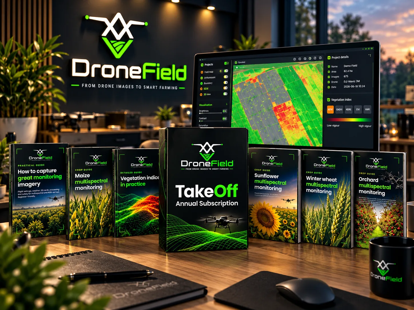
DroneField is more than mapping software. Our Knowledge Base holds ten professional handbooks — each available in nine languages — plus tutorial videos, all in the customer portal. Two handbooks are free after registration; the other eight are part of the subscription.

10 handbooks · 9 languages · tutorial videos · continuously updated

DroneField professional handbooks on a desk, with a multispectral vegetation index map open in the DroneField app on the monitor behind them
Free

Free after registration

Start here. These two handbooks cover the foundations every drone monitoring workflow depends on: capturing imagery that is worth analysing, and understanding what a nutrient map can and cannot tell you.

Practical guide · Free

How to capture great monitoring imagery

For beginners. Flight settings (AGL height, overlap, speed), weather and sun angle, SD cards and image transfer, processing in DroneField and a pre-flight checklist. For multispectral and RGB surveys.

What you will learn

  • Flight height, overlap and speed
  • Weather and sun angle
  • SD card handling and image transfer
  • Processing in DroneField
  • Pre-flight checklist
Read the article →
Practical guide · Free

Nitrogen and foliar feeding from the map

What a multispectral map tells you about nutrient supply — and what it does not. The role and deficiency symptoms of 12 macro- and micronutrients, targeted plant and soil sampling by zone, zoned nitrogen top-dressing, foliar feeding principles, a mixing test and a checklist. No doses or product names.

What you will learn

  • What the map shows about nutrients
  • 12 macro- and micronutrients and their deficiency symptoms
  • Plant and soil sampling by zone
  • Zoned nitrogen top-dressing
  • Foliar feeding principles and mixing test
Subscription

Included in the subscription

Eight handbooks that go deep: the theory and practice of vegetation indices, crop-by-crop guides to reading multispectral maps through the season, and a field manual for documenting wildlife and natural damage.

Detailed guide · Subscription

Vegetation indices in practice

How light becomes a number: RGB and multispectral cameras, reflectance. NDVI, GNDVI, NDRE, EVI and VARI — which one to use and when. Phenology, index choice by crop, reading the map, DroneField presets, and how an index becomes a variable-rate plan. With glossary.

What you will learn

  • RGB vs. multispectral, reflectance
  • NDVI, GNDVI, NDRE, EVI, VARI — which one when
  • Index choice by crop and growth stage
  • Reading the map and DroneField presets
  • From index to variable-rate plan
  • Glossary
Crop guide · Subscription

Maize multispectral monitoring

Growth stages and flight calendar, plant counting, zoning nitrogen top-dressing and weed patches, damage and disease patterns, index selection, variable-rate application and the most common mistakes.

What you will learn

  • Growth stages and flight calendar
  • Plant counting
  • Nitrogen and weed-patch zoning
  • Damage and disease patterns
  • Variable-rate application
  • Common mistakes
Crop guide · Subscription

Winter wheat multispectral monitoring

Growth stages, overwintering assessment, zoning nitrogen top-dressing and fungicide applications, NDRE around heading, and planning the harvest order.

What you will learn

  • Growth stages
  • Overwintering assessment
  • Nitrogen and fungicide zoning
  • NDRE around heading
  • Harvest order
Crop guide · Subscription

Sunflower multispectral monitoring

Plant counting, fungicide zoning, hail damage assessment, why the head misleads the index at flowering, and timing desiccation.

What you will learn

  • Plant counting
  • Fungicide zoning
  • Hail damage assessment
  • Why the head misleads at flowering
  • Desiccation timing
Crop guide · Subscription

Soybean multispectral monitoring

With a South American (Brazil, Argentina) focus and Hungarian notes marked separately. Growth stages, plant stand, weed patches (including Canada thistle), disease and pest patterns, desiccation and variable-rate application.

What you will learn

  • Growth stages
  • Plant stand
  • Weed patches
  • Disease and pest patterns
  • Desiccation
  • Variable-rate application
Crop guide · Subscription

Orchard multispectral monitoring

Per-tree evaluation, row masking, missing-tree inventory, vigour trend, irrigation sectors and picking order. Apple, pear and stone fruit.

What you will learn

  • Per-tree evaluation
  • Row masking
  • Missing-tree inventory
  • Vigour trend
  • Irrigation sectors
  • Picking order
Crop guide · Subscription

Vineyard multispectral monitoring

Canopy-masked maps, inter-row masking, missing-vine list, vigour zones, selective harvest, esca-suspect vines and the recommended flight height.

What you will learn

  • Canopy and inter-row masking
  • Missing-vine list
  • Vigour zones
  • Selective harvest
  • Esca-suspect vines
  • Recommended flight height
Assessment guide · Subscription

Wildlife and natural damage assessment by drone

Documenting wildlife damage (wild boar, deer, roe deer) and natural damage (hail, drought, storm, waterlogging): flight planning, control areas, delineating the damaged area, plant-count-based yield loss estimate, a printable assessment sheet and checklist.

What you will learn

  • Flight planning for damage surveys
  • Control areas
  • Delineating the damaged area
  • Plant-count-based yield loss estimate
  • Printable assessment sheet and checklist

How to get the handbooks

  1. Register for a free DroneField account.
  2. Log in to the customer portal and open the Knowledge Base menu.
  3. Download the free handbooks right away; subscribe to unlock the rest.

The Knowledge Base also contains tutorial videos, and new material is added regularly.

Looking for how the software itself works? The user manual is public: Open the user manual

FAQ

What is in the DroneField Knowledge Base?

Ten professional handbooks on multispectral monitoring — capturing imagery, vegetation indices, crop-specific map reading for maize, winter wheat, sunflower, soybean, orchards and vineyards, nitrogen and foliar feeding, and damage assessment — plus tutorial videos. Everything is available in nine languages in the customer portal.

Are the handbooks free?

Two of them are free after registration: "How to capture great monitoring imagery" and "Nitrogen and foliar feeding from the map". The other eight handbooks are included in the DroneField subscription.

Ready to turn drone data into field decisions?

Download DroneField and start analyzing your fields with one free project.