
DroneField™ ドローン写真を圃場マップや散布計画に変換します。
DJIの測量ドローン画像を、オルソモザイク、植生指数マップ、可変散布計画へ数分で変換するドローンマッピングソフトウェア。処理はすべてお使いのパソコン上で完結します。macOS、Windows、Linuxに対応。
ドローン写真から精密散布まで、シンプルなワークフローで実現。
無料トライアルには1つのプロジェクトが含まれます · 「実際の農業用ドローン運用から生まれたソリューション。」
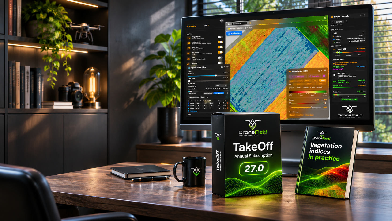
We don't just give you software. We give you the knowledge to turn maps into decisions.
A vegetation index map only pays off when you know what to do with it.
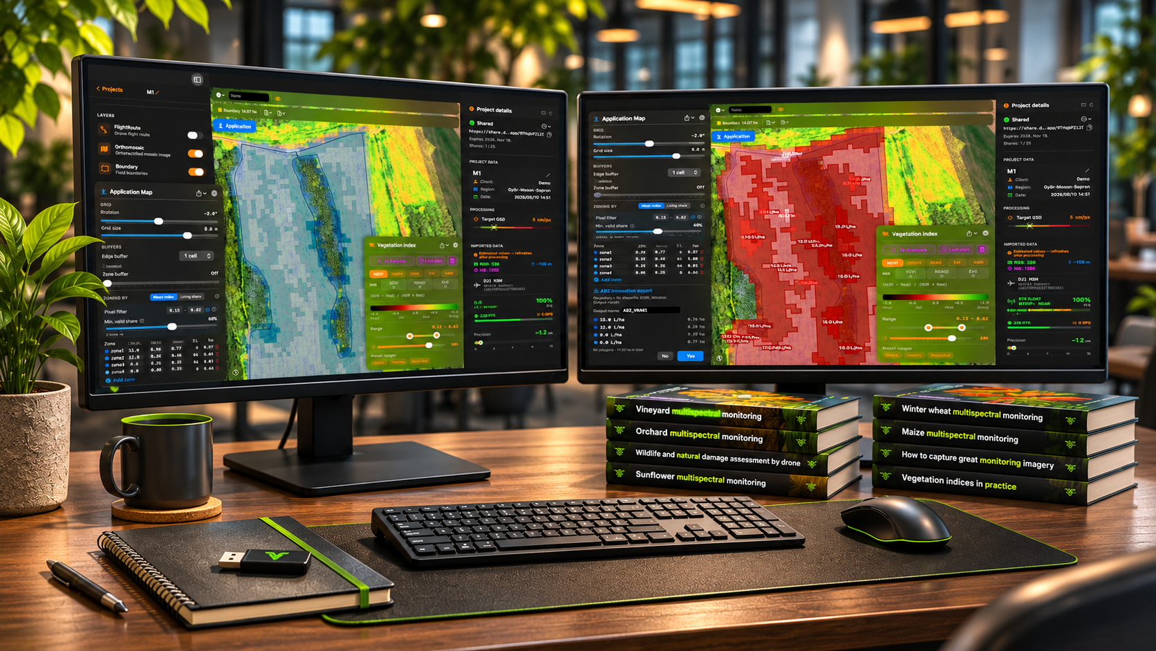
That is why DroneField comes with a growing library of professional handbooks: how to capture good monitoring imagery, which vegetation index to use and when, how to read the map for maize, winter wheat, sunflower, soybean, orchards and vineyards, and how to document wildlife and weather damage. Written by practitioners, for practitioners — with checklists you can take to the field.
10 handbooks · 9 languages · tutorial videos · continuously updated
Free after registration. Eight more handbooks are included in the subscription.
Start reading now: free articles from the handbooks →
“The map shows you where to look. The handbook tells you what you are looking at — and what to do next.”
From "Vegetation indices in practice"
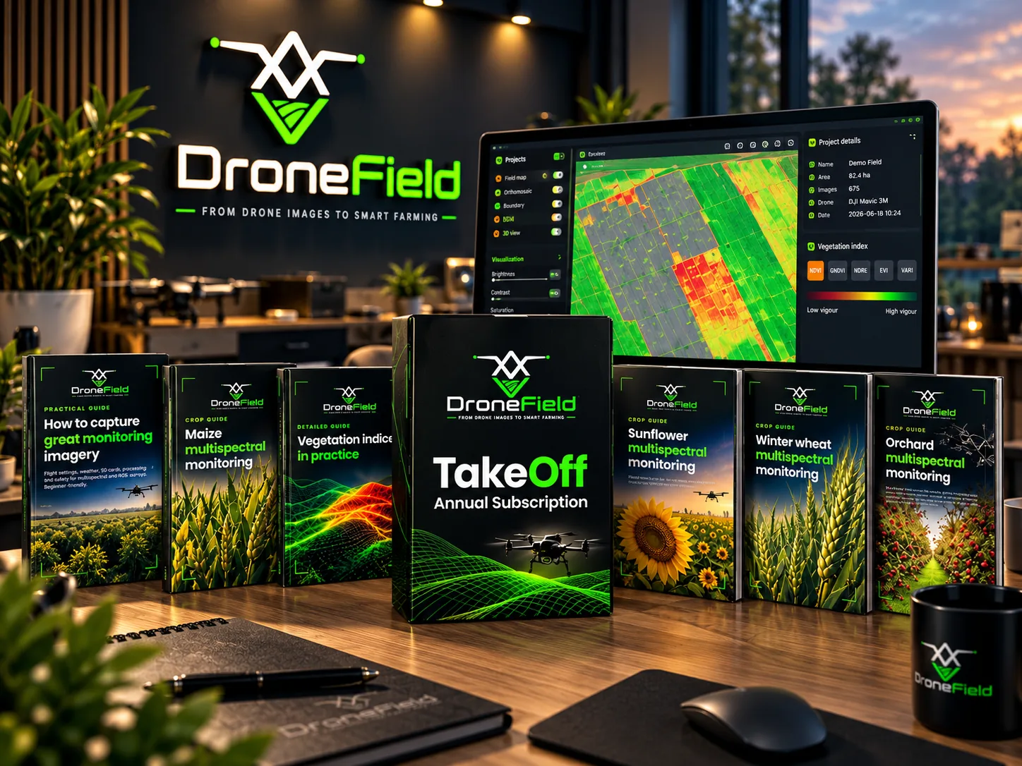
The library
-
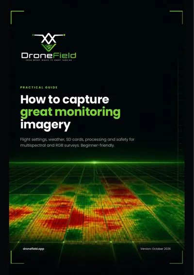 Free Practical guide How to capture great monitoring imagery
For beginners. Flight settings (AGL height, overlap, speed), weather and sun angle, SD cards and image transfer, processing in DroneField and a pre-flight checklist. For multispectral and RGB surveys.
-
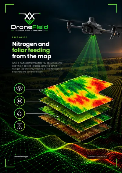 Free Practical guide Nitrogen and foliar feeding from the map
What a multispectral map tells you about nutrient supply — and what it does not. The role and deficiency symptoms of 12 macro- and micronutrients, targeted plant and soil sampling by zone, zoned nitrogen top-dressing, foliar feeding principles, a mixing test and a checklist. No doses or product names.
-
 Subscription Detailed guide Vegetation indices in practice
How light becomes a number: RGB and multispectral cameras, reflectance. NDVI, GNDVI, NDRE, EVI and VARI — which one to use and when. Phenology, index choice by crop, reading the map, DroneField presets, and how an index becomes a variable-rate plan. With glossary.
-
 Subscription Crop guide Maize multispectral monitoring
Growth stages and flight calendar, plant counting, zoning nitrogen top-dressing and weed patches, damage and disease patterns, index selection, variable-rate application and the most common mistakes.
-
 Subscription Crop guide Winter wheat multispectral monitoring
Growth stages, overwintering assessment, zoning nitrogen top-dressing and fungicide applications, NDRE around heading, and planning the harvest order.
-
 Subscription Crop guide Sunflower multispectral monitoring
Plant counting, fungicide zoning, hail damage assessment, why the head misleads the index at flowering, and timing desiccation.
-
 Subscription Crop guide Soybean multispectral monitoring
With a South American (Brazil, Argentina) focus and Hungarian notes marked separately. Growth stages, plant stand, weed patches (including Canada thistle), disease and pest patterns, desiccation and variable-rate application.
-
 Subscription Crop guide Orchard multispectral monitoring
Per-tree evaluation, row masking, missing-tree inventory, vigour trend, irrigation sectors and picking order. Apple, pear and stone fruit.
-
 Subscription Crop guide Vineyard multispectral monitoring
Canopy-masked maps, inter-row masking, missing-vine list, vigour zones, selective harvest, esca-suspect vines and the recommended flight height.
-
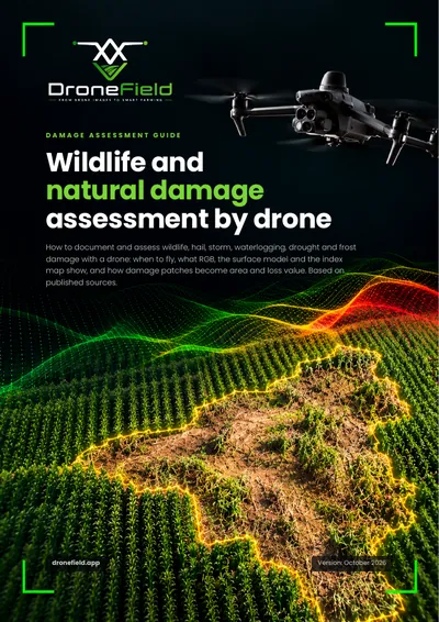 Subscription Assessment guide Wildlife and natural damage assessment by drone
Documenting wildlife damage (wild boar, deer, roe deer) and natural damage (hail, drought, storm, waterlogging): flight planning, control areas, delineating the damaged area, plant-count-based yield loss estimate, a printable assessment sheet and checklist.
散布ワークフロー専用に設計
数時間ではなく、数分で
ドローン画像をインポートし、1回のセッションで散布可能なプランを生成。 複雑な多段階のプロセスは不要です。
あらゆる散布用ドローンへエクスポート
DJI Agras、XAG、ABZ Innovationのドローン、ISOXML端末、Hardi散布機へワンクリックでエクスポート。
運用計画書付き
安全区域、マップ、施用計画を含むPDF調査レポートをワンクリックで作成 — 当局への提出や自社記録にすぐ使えます。
季節をまたいだ圃場データの再利用
圃場の境界、障害物、散布禁止区域を保存。 KMLからインポート、または過去のプロジェクトから再利用可能。
共有
オルソモザイク、散布マップ、飛行計画を誰とでも共有できます — 詳しくはプロジェクト共有をご覧ください。
3Dオルソ
オルソモザイクを3Dで表示して最適な離陸地点を判断し、飛行中の信号ロスを防ぎます。
1つの無料プロジェクトでDroneFieldをお試しください。
測量から散布まで
農業用ドローン運用向けに設計されたシンプルなワークフロー。
圃場の測量
植生の分析
散布計画の作成
エクスポートと実行
精密農業のために設計
ドローンの飛行から圃場での作業に至るまで、必要なすべてのドローン作物分析ツール
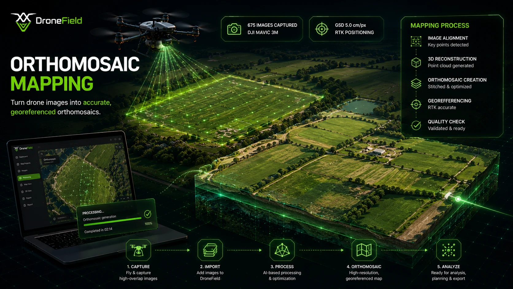
ドローン写真からオルソモザイクへ
ドローン画像を1枚の高解像度な位置情報付き圃場マップに統合します。処理はお使いのパソコン上で行われ、アップロードも待ち時間もありません。
- 地上解像度2 cm/pxから
- 正確な地理参照と投影
- 広大な圃場エリアをシームレスにカバー
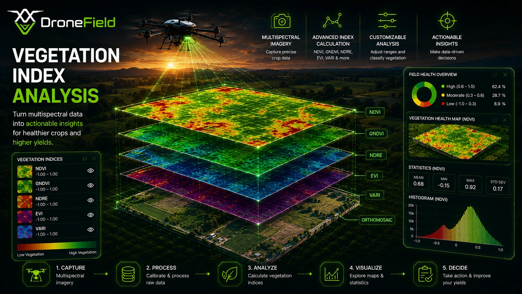
植生指数 — マルチスペクトルとRGB
8種類の植生指数で作物の健康状態を分析します。マルチスペクトルドローンではNDVI、GNDVI、NDRE、EVI、どのRGBカメラでもVARI、VDVI、NGRDI、ExGが利用でき、マルチスペクトルセンサーは不要です。RGB植生指数の仕組み。
- マルチスペクトルドローンでNDVI、GNDVI、NDRE、EVI、VARI
- あらゆるRGBドローンでVARI、VDVI、NGRDI、ExG
- 固定カラースケールで圃場や日付を比較
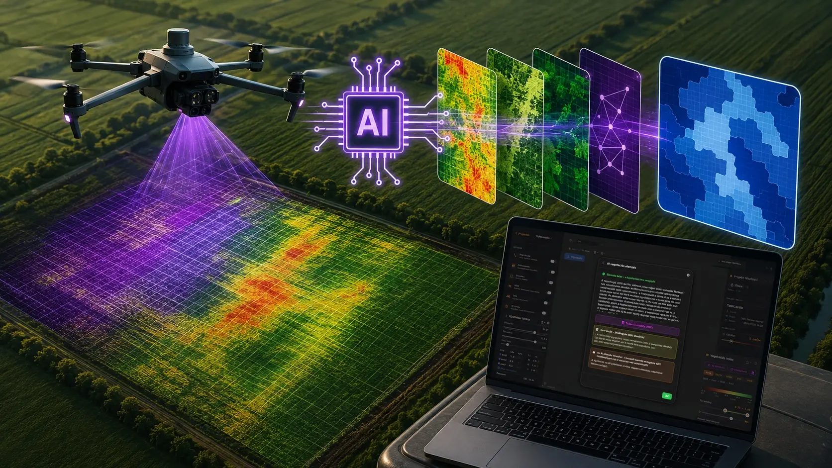
AIによる植生指数分析
ワンクリックでマルチスペクトル測量から散布計画のドラフトを作成。AIアシスタントのLunaが最適な植生指数を選び、平均指数または生存株率で圃場をゾーニングし、施用量を提案してその根拠を説明します。送信されるのは統計データのみで、画像は一切送信されません。AI分析の仕組みを見る。
- 指数の選択、ゾーニング、散布量の提案を数分で
- 共有可能なPDFレポート付きの農学的解説
- ワークフローに組み込まれた専門家の承認
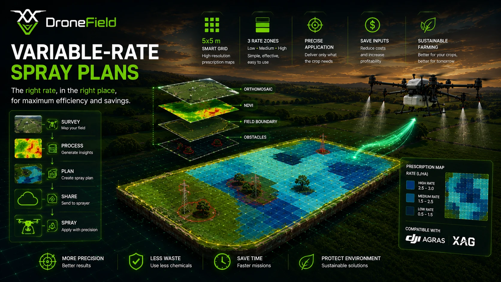
可変散布計画
あらゆる植生指数を、散布幅に合わせたグリッド状の施用マップに変換。ゾーンや施用量を編集すると合計量がリアルタイムで表示されます。
- 平均指数または生存株率によるゾーニング
- ドローンが圃場の端まで散布できるエッジバッファー
- l/haまたはkg/haでの施用量とゾーンごとの合計
エクスポートとワークフローの統合
DroneFieldは、お使いの散布ドローンやトラクター端末ですぐに使える処方マップと圃場境界を作成します。ドローンへ直接、またはUSBメモリへ出力できます。
- DJI Agras、XAG、ABZ Innovation向け処方マップ
- トラクター向けISOXML V3/V4とHardi VRA Shapefile
- GIS向けGeoTIFF、Shapefile、KML
対応施用マップ形式
これにより、ドローン画像の分析から精密な圃場施用へのスムーズな移行が可能になります。
DroneFieldでできること
ドローン測量から精密散布までの完全なワークフロー。
調査から散布までのシンプルなワークフロー
ドローン調査画像を処理し、明確で実用的なワークフローで精密散布計画を生成します。
数分で最適化された散布計画を作成
植生分析に基づいて、ターゲットを絞った散布ゾーンを生成します。
主要な散布システムに対応
DJI Agras、XAG、ABZ Innovation、およびISOBUS対応機器用の散布計画をエクスポートします。
エクスポート形式
KML、Shapefile、ISOXML V3/V4、GeoTIFF、Hardi VRA Shapefileなどの標準的な農業用フォーマットで出力します。
圃場境界のインポート
KMLやShapefileから既存の圃場境界をインポートします。境界線を再描画することなく、以前にマッピングされた圃場を再利用できます。
自動植生分析
植生指数とLuna AIのゾーニングで、ストレスを受けたエリア、雑草の発生箇所、裸地をハイライト表示。GISの専門知識は不要です。
地形解析
ドローン測量画像から地形および標高モデルを生成します。
圃場標高マップ
生成された標高マップを使用して、圃場全体の標高差を可視化します。
安全なドローン運用のサポート
圃場の構造、地形の標高、および運用データにより、パイロットはより安全な散布ミッションの準備ができます。
ワンクリック調査レポート
安全区域、オルソモザイク、DSM、植生指数、境界、施用計画をまとめたPDF調査レポートを作成。そのまま提出・保管できます。
圃場の隠れた知見
従来の地上調査では見えなかった重要な圃場情報を発見します。
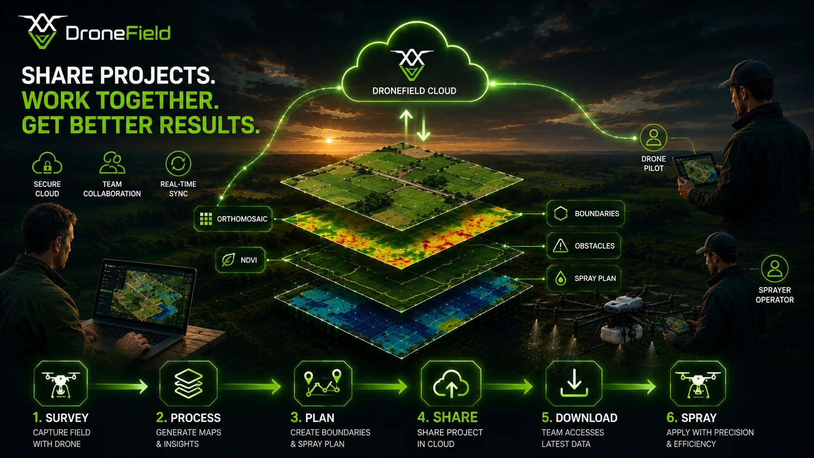
クラウドによるプロジェクト共有
オルソモザイク、散布マップ、飛行計画をクラウドで共有 — パイロットは共有プロジェクトを直接ダウンロードできます。
3Dマップ
地形全体を3Dで確認し、信号ロスを避ける理想的な離陸地点を選べます。
RGB植生指数
マルチスペクトルカメラがなくても大丈夫。VARI、VDVI、NGRDI、ExGにより、対応するRGBドローンが作物分析ツールになり、施用マップも作成できます。
AI圃場境界
圃場内をクリックするだけで、デバイス上のAIが境界をトレース。オフラインで動作し、編集でき、そのまま出力できます。
実際の農業用ドローン運用経験に基づいて構築
マッピングおよび散布済みのヘクタール数
農業用ドローン運用実績年数
精密散布ワークフロー向けに開発
DroneFieldは誰のためのものですか?
農家
ドローン画像を活用して作物を監視し、問題を早期に発見しましょう。
ドローンオペレーター
ドローン調査を専門的な農業用地図に変換します。
農学者
植生を分析し、精密な施用計画を作成します。
シンプルな料金体系
農業用ドローン運用に向けた強力なワークフロー。
DroneField
無料トライアルには1つのプロジェクトが含まれます。
+ 10 professional handbooks and tutorial videos in the Knowledge Base
料金を確認する表示価格は税抜価格であり、適用されるハンガリーの付加価値税は含まれていません。
推奨される測量設定
最適なオルソモザイクの品質と正確な植生分析のため、以下の飛行パラメータを推奨します。
地上サンプリング距離 (GSD)
5 cm
前方オーバーラップ
80%
側面オーバーラップ
70%
標高最適化
ON
これらのパラメータにより、安定した画像アライメント、高精度なオルソモザイク生成、および信頼性の高い植生指数解析が保証されます。
ドローンの互換性
推奨ドローンワークフロー
検証済みのドローンワークフロー
DroneFieldはDJIの測量ドローンに対応しています:Mavic 3 MultispectralおよびEnterprise、Phantom 4 MultispectralおよびRTK、Matrice 4E/4T、さらにベータ版としてMatrice 5TDとZenmuse P1。これらのドローンは、正確なオルソモザイクと植生分析に必要な画像メタデータを提供します。対応ドローンの一覧はドキュメントをご覧ください。
RTKの精度
正確な測量結果を得るためには、RTK測位を強く推奨します。
RTK is essential for:
- 高精度なオルソモザイク生成
- 信頼性の高い植生指数分析
- 正確な圃場計測
- 精密農業ワークフロー
RTKを使用しない場合、農業分析に十分な精度が得られない可能性があります。
ご利用のプラットフォームで利用可能
DroneFieldはmacOS、Windows、Linuxで動作します。お好みのオペレーティングシステムでお使いください。
macOS
Windows
Linux
よくある質問
DroneFieldの散布ワークフローに関するよくある質問
DroneFieldはDJI Agrasに対応していますか?
はい。DroneFieldはDJI Agrasドローン向けの散布計画のエクスポートに対応しています。
DroneFieldはXAGおよびISOBUSシステムに対応していますか?
はい。DroneFieldはXAGドローン、ISOXML V3/V4端末、Hardi散布機向けに散布計画を出力でき、DJI AgrasやABZ Innovationのドローンにも対応しています。
無料トライアルには何が含まれていますか?
無料トライアルには1つのプロジェクトの処理が含まれており、ワークフロー全体をテストすることができます。
圃場境界を再利用できますか?
はい。DroneFieldはKMLやShapefileからの境界データのインポート、および過去の調査データの再利用に対応しています。
DroneFieldではどのようなデータを生成できますか?
DroneFieldでは、オルソモザイク地図、マルチスペクトル・RGB植生指数マップ、AIによるゾーニング、散布処方マップ、等高線付き数値表面モデル、3D地形ビュー、PDF調査レポートを作成できます。
What is in the DroneField Knowledge Base?
Ten professional handbooks on multispectral monitoring — capturing imagery, vegetation indices, crop-specific map reading for maize, winter wheat, sunflower, soybean, orchards and vineyards, nitrogen and foliar feeding, and damage assessment — plus tutorial videos. Everything is available in nine languages in the customer portal.
Are the handbooks free?
Two of them are free after registration: "How to capture great monitoring imagery" and "Nitrogen and foliar feeding from the map". The other eight handbooks are included in the DroneField subscription.
Before you leave…
Did you know variable-rate spraying can reduce pesticide use by up to 60%?
DroneField analyzes drone survey data and helps you create optimized spray plans in minutes.