DroneField™ გარდაქმენით დრონის გამოსახულებები სიზუსტის სოფლის მეურნეობის გადაწყვეტილებაში
ნედლი აეროფოტო გამოსახულებებიდან მოქმედი ველის ინტელექტამდე — ორთომოზაიკის რუკები, ვეგეტაციის ანალიზი და სიზუსტის გამოყენების რუკები ერთ ინტეგრირებულ პლატფორმაზე.
შექმენით თქვენი ანგარიში და დაიწყეთ DroneField აღმოჩენა.
აგრონომებისა და დრონის ოპერატორების მიერ ნდობით მხარდაჭერილია მთელი ევროპაში
Purpose-Built for Spraying Workflows
Minutes, Not Hours
Import drone images and generate a spray-ready map in a single session. No complex multi-step pipelines.
Export to Any Spraying Drone
One-click export for DJI Agras, XAG, and any ISOBUS-compatible sprayer.
Operation Plan Included
Auto-generate drone operation documents with safety zones — ready for authorities or your own records.
Reuse Field Data Across Seasons
Save field boundaries, obstacles, and no-spray zones. Import from KML or reuse from previous projects.
Includes one complete project — no credit card required.
Four Steps from Flight to Spray Mission
Designed for how spraying operators actually work.
Import Drone Images
Generate Orthomosaic & NDVI
Create Variable-Rate Spray Map
Export Mission & Operation Plan
აშენებული სიზუსტის სოფლის მეურნეობისთვის
ყოველი დრონის ფსelnის ანალიზის ხელსაწყო, რომელიც გჭირდებათ დრონის ფრენიდან ველის მოქმედებამდე.
ორთომოზაიკის გენერირება
შეჭიდეთ ასობით მორთმე დრონის გამოსახულებები ერთ გეორეფერენცირებულ მაღალი გარჩევადობის ორთომოზაიკის რუკაში თქვენი მთელი ველის.
- მიწის გარჩევადობა ერთი სანტიმეტრის ქვეშ
- ზუსტი გეორეფერენცირება და პროექცია
- უსაფრთხო დაფარვა ველის დიდი უბნების
NDVI და ვეგეტაციის ინდექსის ანალიზი
გამოთვალეთ NDVI, EVI, VARI და სხვა ვეგეტაციის ინდექსები, რომ აღმოჩინოს ფსeln ჯანმრთელობის ნიმუშები, რომელიც ადამიანის თვალის მიერ უხილავია.
- მульტი-ინდექსის მხარდაჭერა (NDVI, EVI, VARI)
- ზონა-დონის ჯანმრთელობის კლასიფიკაცია
- დროითი შედარება ზრდის ეტაპებს შორის
ცვლადი სიჩქარის გამოყენების რუკები
გენერირების რეცეპტის რუკები ცვლადი სიჩქარის დარგვისთვის, სპილოს დამეტებაზე და ფსeln დაცვისთვის დრონის ვეგეტაციის ანალიზის მონაცემების საფუძველზე.
- შენახვის ოპტიმიზაცია შემცირებს ხარჯებს
- ზონა-ხელმძღვანელი მკურნალობის რეცეპტები
- თავსებადი სიზუსტის გამოყენების აღჭურვილობასთან
სრული დამუშავების სამუშაო ნაკადი
ნახეთ, როგორ მუშავდება დრონის სრული გადაღება — ნედლი სურათებიდან მზა შესხურების გეგმამდე.
- ბოლომდე ბოლომდე დამუშავების სრული პროცესი
- ნედლი სურათებიდან გამოყენებად შედეგებამდე
- სრული სამუშაო ნაკადი ერთ აპლიკაციაში
What You Can Do with DroneField
A complete workflow from drone survey to precision spraying.
Simple workflow from survey to spraying
Process drone survey images and create spray missions in a clear and simple workflow designed for agricultural drone pilots.
Create optimized spray plans in minutes
Generate precision spraying zones quickly using NDVI analysis and grid-based prescription maps.
Supported spraying platforms
Export spraying maps for major agricultural drone and machinery platforms. Supported systems: DJI Agras, XAG, and ISOBUS compatible equipment.
Export formats
Export your prescription maps in widely used agricultural formats. Supported exports: KML, Shapefile, and ISOXML.
Import field boundaries
Import existing field boundaries and data directly from KML and Shapefile. Reuse data from previous surveys without redrawing fields.
Predefined NDVI analysis
Identify stressed or weed-affected vegetation areas using predefined NDVI analysis profiles designed for agricultural drone surveys.
3D terrain model
Generate a terrain model from drone survey data to better understand elevation changes across your field.
Field elevation map
Visualize elevation differences across the field with a generated height map.
Flight safety information
Get important flight safety information based on the surveyed field and terrain conditions.
Automatic flight log records
Generate mission documentation and flight log records automatically from your survey data.
Hidden field insights
Discover valuable information about your fields that is not visible during normal field inspection.
შექმნილია პროფესიონალი დრონის ოპერატორებისთვის
სიზუსტის საჰაერო მონაცემთა დამუშავება, რომელიც განკუთვნილია რეალური სოფლის მეურნეობის შესხურებისა და რუკის შედგენის სამუშაო ნაკადებისთვის.
დაიწყეთ თქვენი დრონის მონაცემების დამუშავებაBuilt from Real Agricultural Drone Experience
hectares mapped and sprayed
years in agricultural drone operations
built for spraying workflows
ვისთვის არის DroneField?
ფერმერები
მონიტორინგი გაუწიეთ კულტურებს, აღმოაჩინეთ სტრესი დროულად და გამოიყენეთ რესურსები მხოლოდ იქ, სადაც სჭირდება.
დრონის ოპერატორები
გადააქციეთ დრონის გადაღება პროფესიონალურ სოფლის მეურნეობის რუკებად, კლიენტისთვის მზად.
აგრონომები
განსაზღვრეთ მართვის ზონები და შეადგინეთ მონაცემებზე დაფუძნებული მკურნალობის გეგმები.
Simple Pricing
One powerful workflow for agricultural drone operations.
DroneField
Free trial includes one project.
See PricingEarly adopters can renew at the same 512 € yearly price.
The displayed prices are net prices and do not include the applicable Hungarian Value Added Tax.
რეკომენდირებული კვლევის პარამეტრები
ოპტიმალური ორთომოზაიკის ხარისხი და ზუსტი ვეგეტაციის ანალიზი რეკომენდირებული ფრენის პარამეტრებს.
მიწის სემპლირებული დისტანცია (GSD)
5 cm
წინა გადახურვა
80%
გვერდითი გადახურვა
70%
სიმაღლის ოპტიმიზაცია
ON
ეს პარამეტრები უზრუნველყოფს სტაბილურ გამოსახულების დამთავრება, მაღალი სიზუსტის ორთომოზაიკის გენერირება და საიმედო ვეგეტაციის ინდექსის ანალიზი.
დრონის თავსებადობა
რეკომენდირებული დრონის სამუშაო ნაკადი
ტესტი დრონის სამუშაო ნაკადი
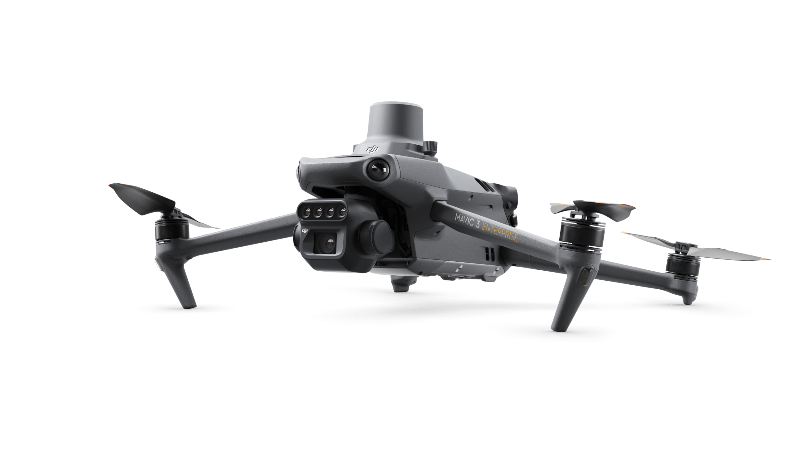
DroneField ტესტი პროფესიონალური დრონის კვლევის სამუშაო ნაკადებთან DJI Mavic 3 და DJI Phantom 4 პლატფორმებით, რომელიც აწვდის სტაბილური გამოსახულებები და საიმედო მეტამონაცემებს ორთომოზაიკის დამუშავება და ვეგეტაციის ანალიზი.
RTK სიზუსტე
ზუსტი კვლევის შედეგებისთვის RTK პოზიციონირება ძლიერ რეკომენდირებული.
RTK is essential for:
- მაღალი სიზუსტის ორთომოზაიკის გენერირება
- საიმედო ვეგეტაციის ინდექსის ანალიზი
- ზუსტი ველის გაზომვა
- სიზუსტის სოფლის მეურნეობის სამუშაო ნაკადი
RTK გარეშე, რუკის სიზუსტე შეიძლება არასაკმარისი იყოს საიმედო სოფლის მეურნეობის ანალიზი.
ხელმისაწვდომია თქვენს პლატფორმაზე
DroneField მუშაობს macOS, Windows და Linux სისტემებზე — გამოიყენეთ თქვენთვის სასურველ ოპერაციულ სისტემაზე.
macOS
Windows
Linux
Frequently Asked Questions
Common questions about DroneField for spraying workflows.
Does DroneField support DJI Agras T-series?
Yes. DroneField exports spray maps directly in DJI Agras format. Upload the mission file and fly.
What about XAG and ISOBUS sprayers?
DroneField exports to XAG format and generates ISOBUS-compatible files for any standard sprayer.
What exactly is included in the free trial?
One complete project from start to finish: import drone images, generate orthomosaic and NDVI, create a spray map, and export the mission file. No credit card needed.
Can I reuse field data across seasons?
Yes. Save your field boundaries, obstacles, and no-spray zones once, then reuse them in future projects or import from KML files.
Does DroneField generate operation documents?
Yes. DroneField auto-generates drone operation plans including safety zone information — ready for regulatory submission or your own records.
From Drone Images to Spray Missions
Try the complete workflow with one free project. See how fast it can be.
Start Free TrialNo credit card required • One complete project included
Before you leave…
Did you know variable-rate spraying can reduce pesticide use by up to 60%?
DroneField analyzes drone survey data and helps you create optimized spray plans in minutes.