
DroneField™ Turn drone imagery into field maps and spray plans.
Drone mapping software that processes drone images, detects crop stress, and generates variable-rate spray plans in minutes. Runs on macOS, Windows, and Linux.
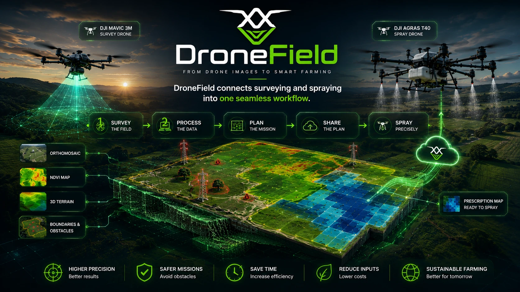
From drone survey to precision spraying — in a single workflow.
Free trial includes one project · Built on real agricultural drone operations.
Purpose-Built for Spraying Workflows
Minutes, Not Hours
Import drone images and generate a spray-ready plan in a single session — no complex multi-step pipelines.
Export to Any Spraying Drone
One-click export for DJI Agras, XAG, ABZ Innovation, and any ISOBUS-compatible sprayer.
Operation Plan Included
Auto-generate drone operation documents with safety zones — ready for authorities or your own records.
Reuse Field Data Across Seasons
Save field boundaries, obstacles, and no-spray zones. Import from KML or reuse them from previous projects.
Share
Share the orthomosaic, application map, and flight plan with anyone — see project sharing for details.
3D Ortho
View the orthomosaic in 3D to decide the best takeoff point and avoid signal loss during flight.
Try DroneField with one free project.
From Survey to Spraying
A simple workflow designed for agricultural drone operations.
Survey the field
Analyze vegetation
Build the spray plan
Export and execute
Built for Precision Agriculture
Everything you need to go from drone survey to field action — in one application.
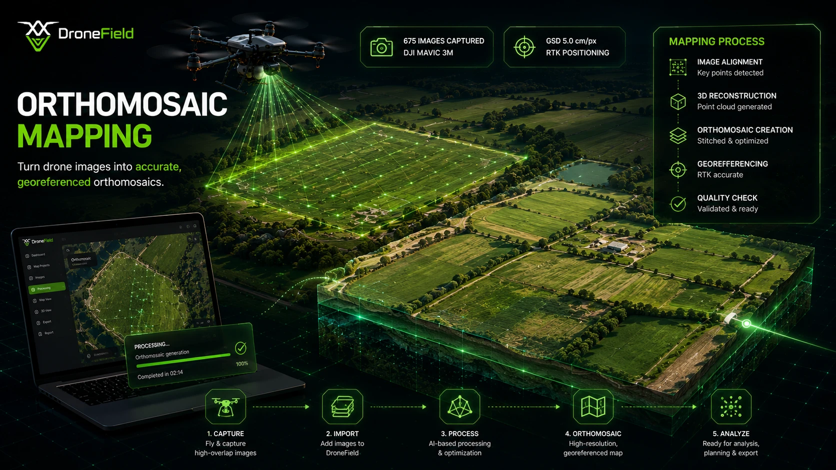
Orthomosaic Mapping
Stitch drone images into one high-resolution, georeferenced field map.
- Centimeter-level ground resolution
- Accurate georeferencing and projection
- Seamless coverage of large field areas
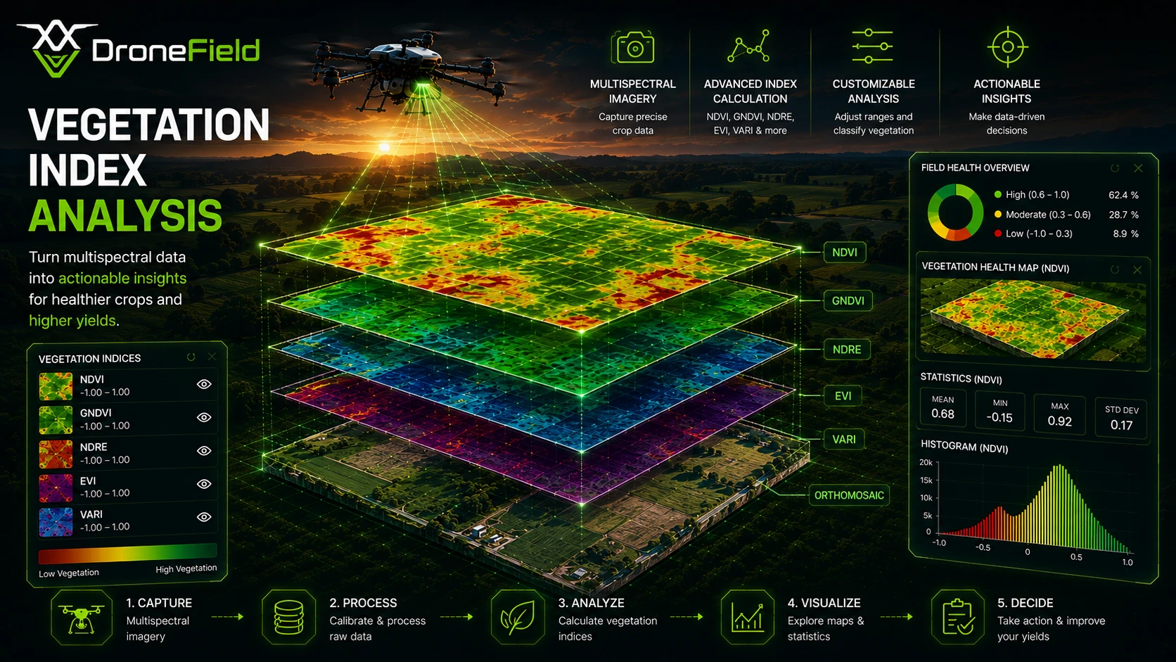
Vegetation Index Analysis
Analyze crop health using NDVI and other multispectral vegetation indices.
- Multi-index support (NDVI, EVI, VARI)
- Zone-level health classification
- Temporal comparison across growth stages
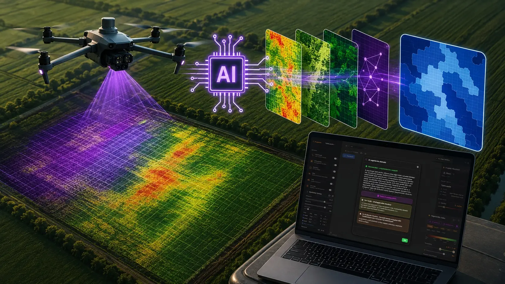
AI Vegetation Index Analysis
One click turns a multispectral survey into a draft spray plan: the Luna AI assistant picks the right vegetation index, zones the field, and explains its reasoning. See how AI analysis works.
- Index choice, zoning, and dose suggestions in minutes
- Agronomic explanation with a shareable PDF report
- Expert approval built into the workflow
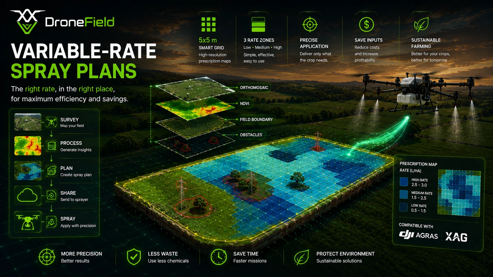
Variable-Rate Spray Plans
Generate precision treatment maps from your vegetation analysis.
- Input optimization that reduces costs
- Zone-based treatment prescriptions
- Compatible with precision application equipment
End-to-End Processing
See a complete drone survey processed — from raw imagery to a finished spray plan. Learn more about our processing workflow.
- End-to-end processing pipeline
- From raw imagery to actionable output
- Complete workflow in a single application
Share Your Project
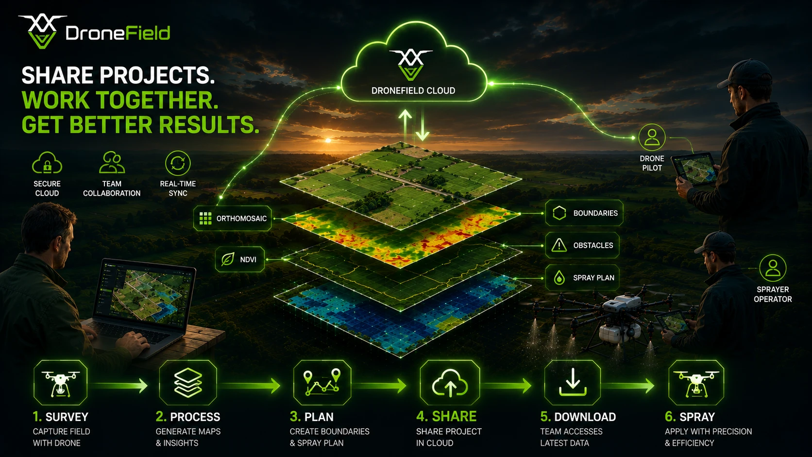
Share your project with everyone through our cloud service — the spray drone pilot can download the flight plan directly. Shared projects need very little bandwidth: the orthomosaic is compressed, so it stays smooth even on a weak internet connection. Learn more about project sharing and managing shares.
- Cloud sharing with anyone — no installation needed
- Direct flight-plan download for spray pilots
- Compressed orthomosaic for low-bandwidth connections
What You Can Do with DroneField
A complete workflow from drone survey to precision spraying.
Survey-to-Spraying Workflow
Process drone survey imagery and generate precision spray plans in one clear, practical pipeline.
Optimized Spray Plans in Minutes
Generate targeted application zones automatically from vegetation analysis.
Compatible with Major Spraying Systems
Export spray plans for DJI Agras, XAG, ABZ Innovation, and ISOBUS-compatible equipment.
Standard Export Formats
Export in standard agricultural formats — KML, Shapefile, and ISOXML.
Reusable Field Boundaries
Import existing field boundaries from KML or Shapefile. Reuse previously mapped fields without redrawing.
Automatic Vegetation Analysis
DroneField highlights stressed and weed-affected areas automatically, with no GIS expertise required.
Terrain Analysis
Generate terrain and elevation models directly from your drone survey imagery.
Field Elevation Maps
Visualize elevation differences across the field using a generated height map.
Safer Drone Operations
Field structure, terrain elevation, and operational data help pilots prepare safer spraying missions.
Automatic Flight Records
Generate flight documentation and operation records automatically from your survey data.
Hidden Field Insights
Surface field patterns that are invisible during traditional ground inspection.
Project Sharing via Cloud
Share orthomosaics, application maps, and flight plans through our cloud — pilots download the shared project directly.
3D Map
Review the full terrain in 3D and pick the ideal takeoff point to avoid signal loss.
Curious what DroneField can do for your fields?
Put it to the test with a free trial.
Start Free TrialBuilt for Professional Drone Operators
Precision aerial processing designed for working agricultural spraying and mapping workflows.
Start Processing Your Drone DataBuilt from Real Agricultural Drone Experience
hectares mapped and sprayed
years in agricultural drone operations
built for precision spraying workflows
Who DroneField Is For
Farmers
Monitor crop health, catch stress early, and apply inputs where they matter.
Drone Operators
Turn drone surveys into professional, deliverable agricultural maps.
Agronomists
Identify management zones and design data-driven treatment plans.
Simple Pricing
One powerful workflow for agricultural drone operations.
DroneField
Free trial includes one project.
See PricingThe displayed prices are net prices and do not include the applicable Hungarian Value Added Tax.
Recommended Survey Settings
For optimal orthomosaic quality and accurate vegetation analysis we recommend the following flight parameters.
Ground Sampling Distance (GSD)
5 cm
Front Overlap
80%
Side Overlap
70%
Elevation Optimization
ON
These parameters ensure stable image alignment, high-precision orthomosaic generation, and reliable vegetation index analysis.
Drone Compatibility
Recommended Drone Workflow
Tested Drone Workflows
DroneField has been tested with professional drone survey workflows using DJI Mavic 3 and DJI Phantom 4 platforms, providing stable imagery and reliable metadata for orthomosaic processing and vegetation analysis. See the full list of supported drones in our documentation.
RTK Accuracy
For accurate survey results, RTK positioning is strongly recommended.
RTK is essential for:
- High-precision orthomosaic generation
- Reliable vegetation index analysis
- Accurate field measurements
- Precision agriculture workflows
Without RTK, mapping accuracy may not be sufficient for dependable agricultural analysis.
Available on Your Platform
DroneField runs on macOS, Windows, and Linux — use it on the operating system you prefer. Check the detailed system requirements in our documentation.
macOS
Windows
Linux
Frequently Asked Questions
Common questions about DroneField for spraying workflows.
Does DroneField support DJI Agras?
Yes. DroneField supports spray plan export for DJI Agras drones.
Does DroneField support XAG and ISOBUS systems?
Yes. DroneField supports exporting spray plans for XAG drones and ISOBUS compatible equipment.
What is included in the free trial?
The free trial includes processing of one project so you can test the complete workflow.
Can I reuse field boundaries?
Yes. DroneField supports importing boundaries from KML or Shapefile and reusing data from previous surveys.
What type of data can DroneField generate?
DroneField can generate orthomosaic maps, NDVI analysis, spray prescription maps, terrain models and field elevation maps.
Ready to try DroneField?
Test the complete workflow with one free project.
Start Free TrialNo credit card required • One complete project included
Before you leave…
Did you know variable-rate spraying can reduce pesticide use by up to 60%?
DroneField analyzes drone survey data and helps you create optimized spray plans in minutes.